


TELEVISION INSPECTIONS AND MAPPINGS IN PIPES, CAVITIES, WELLS, SEWERS IN LIGURIA
SEWER VIDEO INSPECTIONS
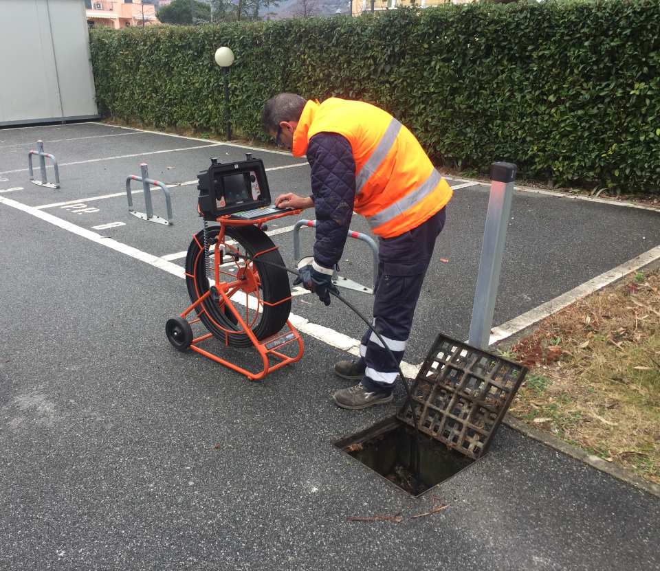
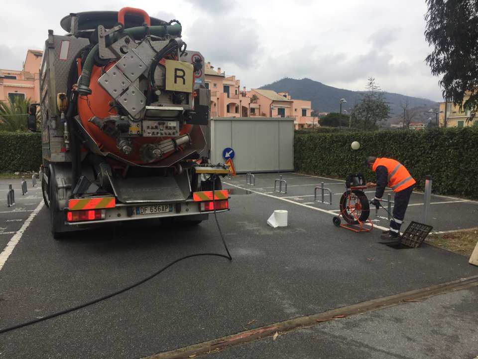
Servizi Ecologici is equipped with cameras for television inspections in pipes, cavities, wells, sewers, chimneys and environments with difficult access. The cameras can do non-destructive searches, the latter are equipped with sensors that allow the location of the height and the exact point of breakage of the pipe allowing targeted interventions. All inspections with camera performed by us are recorded on video cassettes that are delivered to the customer together with a written or recorded report.
SERVICE
- Television inspections and mapping
- TV inspections conducted of different sizes, cavities, sewers and chimneys
- non-destructive research
- Technical report with video report delivered to the customer
MAPPING OF ELECTRICITY AND WATER NETWORKS
We are also equipped with a locator for the search of electrical cables or metal pipes. With this locator, it is possible to follow the traces of pipes or electrical cables so as to be able to realise the passage of the water or electricity network, this device can be used for the identification of pipes or cables during excavations.
The device also provides the depth of the pipes found. Equipped with a geophone for the search for leaks in pressurised pipes, it can be proposed as a service for the detection of networks and leaks of both water and gas. The water that escapes from a pressurised pipe causes vibrations that propagate in the surrounding ground and are thus noticeable on the surface.
The “vibrometer probe” collects these vibrations and transmits them to the receiver, which highlights their extent on the instrument's index and in the headphones as an amplified sound signal.
Mappings and cartography
Ecological Services, through a computer programme, is able to create on computer and cartographic support, the mapping of sewer and water networks.
Computerised mapping of the network collects the classic topographic survey with the collection of data on the actual state of the network inspected from the inside by cameras.
Video inspection allows us to collect a large amount of information to evaluate the real situation of the section of the network that interests us, while the topographical position of even the single defect or connection allows for targeted maintenance interventions.
Having a paper document that can be read immediately in any condition allows the manager of an underground network to know exactly the path of the network, the position of each detail, the actual condition of the section metre by metre, the existence of hidden accesses covered by the evolution of surface structures (asphalt, construction works, etc.).
It can be said that the network mapping functions as a historical memory of the television survey as well as a field connection of the alphanumeric archive of data.
Do you want to receive more information or a quote for a video inspection?


REGISTERED OFFICE
Via Fieno, 3 - 20123 Milano
OPERATIONAL HEADQUARTERS
CONTACTS
+39 019 690774
+39 019 690778
serviziecologici@pcert.postecert.it
CUSTOMER SERVICE
24-hour emergency assistance 7 days a week

 |
Questa azienda è presente anche su
|
Questa azienda è presente anche su  e
e 